experience to be trusted
About Us
Senseimage Technologies was founded by a team of talented individuals who transformed their academic expertise to develop robust, industry-focused solutions using advanced UAV (Unmanned Aerial Vehicle) technology. By specializing in manufacturing drones, Senseimage provides innovative tools tailored to address complex industrial challenges efficiently and effectively.
worldwide reach
Global capacity
SenseImage Technologies specializes in the integration of advanced UAV (drone) data acquisition technologies with high performance GIS analysis and visualization tools to produce rich client specific data sets, high quality imagery, terrain feature models and geo-referenced asset inspection and facilities management information.
We are a group of engineers wanted to achieve and give some industrial solutions using the UAV’s instead for fun flying and hobbies. After a continuous research of 5 years of R&D and 2 years of product oriental research we came up with a solution and started SENSEIMAGE TECHNOLOGIES innovations in the mid half of 2017.
experience to be trusted
Our Accomplishments
worldwide reach
Our Work Process
Nation Wide Operation
Extending our top-notch drone services across the country, numerous private firms and government agencies swear by our deliverables. Be a part of the SenseImage’s Drones community for the quality upkeep of your assets anywhere within India.
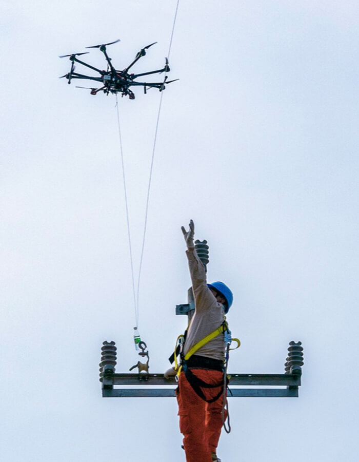
Innovative Technology
Supported by revolutionary drone technology, artificial intelligence, and a versatile number of softwares, our users are guaranteed to procure precise and secure data even from the most vulnerable locations.
Wide range of Industries
")

client's testimonial
OUR PArtners